United States Department of Agriculture
AgResearch Magazine


Remote Sensing Keeps an Eye on Natural Resources
|
|

In 1991, an outbreak of infant birth defects was discovered in the Lower Rio Grande Valley of south Texas. U.S. Environmental Protection Agency scientists and Texas state public health and conservation agencies looked for a reason.
Two years later, the investigation turned up "a smoking gun"--a carp caught in a local waterway and stored in a home freezer. That fish was found to contain highly toxic polychlorinated biphenyls, commonly known as PCBs. Additional fish from a nearby canal also had high levels of PCBs.
Officials suspected the source of the poison could have been coolant leaked from a refrigerator discarded somewhere near the large canal where the fish had been caught.
Charles F. Webster, an aquatic scientist with the Texas Natural Resource Conservation Commission, found PCB contamination in more fish samples collected in and around the Donna Reservoir in the Lower Rio Grande Valley. So Agricultural Research Service remote-sensing scientists at Weslaco, Texas, collaborated with Webster to help locate the PCB source using aerial photography.
Photographs taken near the canal at an altitude of about 9,800 feet revealed an unauthorized solid waste disposal site obscured from ground view by dense vegetation. Photographs taken a week later at a lower attitude revealed no abandoned, 1970s-vintage electrical products that might have contained PCBs. Thus, the mystery has not yet been completely solved.
The incident nonetheless revealed the value of using aerial photography to locate pollutants originating from illegal waste-disposal sites. That's just one of the spinoffs of remote-sensing technology originally developed by ARS to help manage agricultural resources using the satellite-based Global Positioning System (GPS) and Geographic Information System (GIS) technologies.
|
|

As the PCB case showed, remote sensing is not just for site-specific farming. ARS rangeland scientist James H. Everitt and the team he leads at Weslaco's Kika De La Garza Subtropical Agricultural Research Center are evaluating the potential of various remote sensing technologies to survey secluded public lands and coastal areas, as well as farms. The surveys can help researchers monitor the health of the environment.
Some surveys are best achieved with sophisticated multispectral sensors aboard satellites, while others simply use photographic or color video cameras in fixed-wing aircraft or helicopters.
The remote-sensing group at Weslaco uses a Cessna 404 Titan aircraft flown by ARS pilot M. Rene Davis. Mounted vertically on the floor of the aircraft is a three-camera, multispectral video system that's operated by ARS remote-sensing specialist David E. Escobar. This system, which has obtained imagery from altitudes ranging from 1,000 to 12,000 feet, readily acquires color-infrared imagery that simulates color-infrared photography. This type of imagery can be evaluated immediately after the flyover, unlike color-infrared, which must first be processed in a special lab.
When Everitt and the late Jim Richerson, an entomologist with Sul Ross State University in Alpine, Texas, were investigating locoweed infestations on cattle rangelands, the video system's infrared imagery played a major role.
A prolonged drought in west Texas in 1995 had turned Richerson's attention to western pine beetles. Landowners and the Nature Conservancy, which had purchased thousands of acres in the Davis Mountains, went to him with concerns over already drought-stressed ponderosa pines being further ravaged by a population explosion of the destructive pine beetles. Ponderosas make up an important part of the Davis Mountain ecosystem, preventing erosion and giving shelter to deer and white-wing doves—two highly prized game species.
|
|
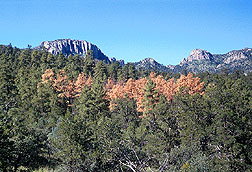
Scanning aerial surveys of the rugged terrain, Richerson and Everitt found that the Texas infestations grew in orderly clusters of trees, unlike the haphazard pattern of beetle infestations Richerson had observed in California, Washington, and British Columbia. While the meaning of the clusters is not yet clear, Richerson believed that studies of the beetles' feeding behavior may be key to finding ways to control their further spread.
Where researchers and resource managers once had to trek through treacherous terrain to survey the health of a forest system, aerial remote sensing now gives them a faster, easier, and less expensive way to spot troubled trees. As a result, they have hard data showing that western pine beetles have killed about 2 percent of the trees in a canyon area extending about 6 miles south from Mount Livermore to the nearest road. That information is extremely important to forest managers who see the dead trees as increased dry organic matter that could fuel forest fires.
To survey the pine forest, the scientists used both color-infrared and conventional color aerial photography, as well as the three-camera, multispectral, digital video imaging system integrated with a GPS system. The GPS latitude and longitude data on the video imagery, in combination with a base map of the area, provided geographic references to bark beetle infestations.
Similar technologies are helping Everitt and his colleagues study large areas of riparian vegetation--the plant life along streams and rivers and in tidewater areas.
For example, they have mapped Chinese tamarisk, or saltcedar, along the Colorado River in southwestern Arizona, the Rio Grande River in west Texas, and the Pecos River in west-central Texas. Since its introduction as an ornamental shrub from Asia in the 1800s, saltcedar has formed low, dense thickets that displace native vegetation, impede streamflow, increase sedimentation, steal precious water, and increase soil salinity.
To Monitor Wildlife Habitats
|
|
Invasions by alien plants, intensive agriculture, and urbanization all pose a threat to fragile ecosystems and the wildlife they contain. There is particular concern in Texas for bobcats and endangered ocelots that occupy the same territory but do not interbreed. The two depend on habitat in a narrow corridor along the Rio Grande.
As a first step toward choosing the most useful sites for cat habitat restoration, Gerald L. Anderson, an ARS ecologist formerly at Weslaco and now at Sidney, Montana, along with U.S. Fish and Wildlife Service colleagues, identified vegetation in areas of the Santa Ana National Wildlife Refuge--an important habitat for both species. The scientists monitored the cats' whereabouts by outfitting them with radiotelemetry devices and using GIS technology.
Migratory birds also depend on Rio Grande Valley habitat for lunch breaks as they travel the central flyway system between the Arctic and Central America. At the University of Texas-Pan American in Edinburg, Texas, effects of changing vegetation patterns on birds and other wildlife are among the concerns of biologist Frank W. Judd and botanist Robert I. Lonard.
Wholesale riparian deforestation in the Lower Rio Grande began about 1910, Lonard says. Today, less than 5 percent of the land area is covered by woody plants. In cooperation with the university, ARS scientists have applied their remote sensing expertise to a variety of research projects involving natural resources—from the Lower Rio Grande to islands along the Texas Gulf Coast.
|
|
Modern survey technology developed by ARS will be useful to the U.S. Fish and Wildlife Service and the Texas Parks and Wildlife Service. It will help those agencies' resource managers lessen the impact of urbanization and other stresses on the local ecology. Studying a wet year that followed a dry year, the researchers found that color-infrared photography showed striking changes in the abundance and vigor of different species of riparian vegetation in three wildlife refuges in the Lower Rio Grande.
Along the Texas Gulf Coast, researchers worked out methods to monitor changes in the location and abundance of oyster reefs and black mangroves. From Galveston to Port Isabel, Texas, small plants and animals that could not survive on a bare, muddy, bay floor thrive on reefs and provide sustenance for commercial fish. Black mangroves, as the only woody plant species along the lower Texas coast, grow thick masses of roots that stabilize the shore and provide habitat for diverse species.
To Keep Tabs on Aquatic Plants
In 1987, ARS and University of Texas-Pan American scientists began evaluating aerial photography and videography as a means to monitor the vegetation that stabilizes the shoreline on Texas' South Padre Island. Now, airborne multispectral videography enables them to measure the amount of ground cover on the island with 98 percent accuracy. In the 1980s, the diversity of plant species on the backshore and primary dunes was declining.
"Hurricanes took a toll, but we could attribute most of the decline to recreational use of all-terrain vehicles," Lonard says. Since the study, rentals of the 4-wheel drive vehicles have been discontinued.
In the lower Laguna Madre area, South Padre Island's bayside is a flat, sandy area a few miles wide that looks like a desert covered with a carpet of blue-green algae. Wading birds like the snowy plover, the piping plover, and reddish egret dot the landscape as they feed on the algae.
But more than just birds depend on these algae that convert nitrogen from the air into nitrates. High tides flush much of the nitrates out into the bay, providing nutrients for aquatic life.
|
|
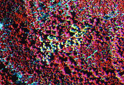
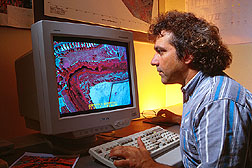
Multispectral sensors aboard space satellites have provided Judd with images of the ever-changing expanse of blue-green algae. Low-altitude aerial videography helps him interpret the coarse-resolution satellite imagery with better detail. For use aboard aircraft, ARS researchers have recently developed a digital video imaging system that simulates Landsat's thematic mapper's mid-infrared, near-infrared, and visible-red bands. This system provides more detailed resolution for interpreting satellite imagery.
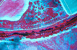
Everitt and his colleagues have also been using multispectral digital imagery to characterize marshes near the mouth of the Rio Grande. Salt, brackish, and freshwater marshes each have differing patterns of vegetation, though one vegetation zone may be only centimeters higher above sea level than another.
For example, digital video images show bright-pink to red shades in the lower zone of brackish marshes, where maritime saltwort prevails and the mineral salt concentration is less than seawater's 35 parts per thousand.
In the next zone, shoregrass appears dark brown. Above the shoregrass zone is Gulf cordgrass and, at the upper margin, shrubs grow in water with as little as 5 parts of mineral salts. On the images, the cordgrass zone appears light gray to pinkish tan. The images reveal shifts of these zones as waterflow through the river system is reduced during dry weather or from dams.
Noxious aquatic weeds are the latest plants to come under remote sensing surveillance by Everitt and his colleagues. In the summer of 1998, hydrilla and water hyacinth--alien additions to the Texas landscape--have thrived in waterways that nearly dried up during drought. The scientists are detecting and mapping these weed infestations in Lower Rio Grande waterways, including the river itself.—By Ben Hardin, Agricultural Research Service Information Staff.
This research is part of Soil Quality and Management, an ARS National Program described on the World Wide Web at http://www.nps.ars.usda.gov/programs/nrsas.htm.
James H. Everitt is in the USDA-ARS Integrated Farming and Natural Resources Research Unit, 2413 E. Hwy. 83, Weslaco, TX 78596; phone (956) 969-4824, fax (956) 969-4800.
"Remote Sensing Keeps an Eye on Natural Resources" was published in the July 1999 issue of Agricultural Research magazine.