United States Department of Agriculture
AgResearch Magazine


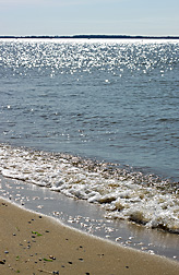
There’s More Than One Way To Save the Bay
|
|
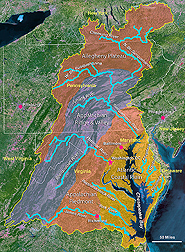
It’s about a 5-hour drive from the Chesapeake Bay’s Eastern Shore in Maryland to the Agricultural Research Service Pasture Systems and Watershed Management Research Unit in University Park, Pennsylvania. This is where six ARS scientists are monitoring agricultural pollutants that are washed out of crop fields and eventually discharged into the bay—and creating all the roadblocks they can along the way. The ARS team has been able to work in all the major physical and geographic regions of the Chesapeake Bay Watershed by developing a six-state network of collaborators.
“Some of our research is quantifying how farming contributes to nutrient runoff,” says ARS soil scientist Peter Kleinman. “But we’re also testing and developing new practices and strategies for improving the odds that plant nutrients like nitrogen and phosphorus are taken up by crops and don’t escape to the bay.”
Please Step Away From the Streambank
|
|
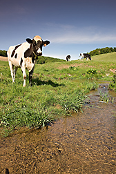
Kleinman’s work started in New York’s Allegheny Plateau (see map), a forested expanse broken up by small dairy farms, where the University Park team oversees activities in the Town Brook Watershed as part of the Conservation Effects Assessment Project (see “ARS Chesapeake Bay Research Intensifies” in this issue). Although the area is just outside of the Chesapeake Bay Watershed, farming practices in the Town Brook Watershed closely resemble those across the Allegheny Plateau—the headwater region of the the Chesapeake’s watershed.
Kleinman’s team determined that the equivalent of 12 percent of the phosphorus load in the Town Brook Watershed—a major source of drinking water for New York City—came from dairy cow dung deposited directly in streams. The findings helped convince local farmers to install more streambank fencing to keep cows away from streambeds and to improve water quality.
Testing Apps in Appalachia
|
|
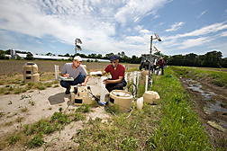
The ARS team often test-drives their practices and procedures in the Mahantango Watershed, a long-term experimental watershed 2 hours southeast of University Park that is part of the Appalachian Ridge and Valley Region.
This is where soil scientist John Schmidt has been testing a sensor system to help farmers fine-tune applications of nitrogen to knee-high corn crops. The small sensors are mounted in front of a tractor and measure yellow-amber and near-infrared light waves from the corn plants. A computer uses the data to calculate the amount of nitrogen that should be added to the soil and transmits this information to the applicator, which amends the field with the appropriate levels of nitrogen.
“If we match the amount of nitrogen that’s applied with the amount that the crop needs, then less nitrogen will be leached out of the field—and the yields should be greater,” Schmidt says. “It’s also a way to get on-the-go recommendations for nitrogen applications, instead of sending soil samples off for testing.”
|
|

Schmidt and University Park research leader Ray Bryant are also testing a proprietary nitrogen fertilizer formulation developed in the United Kingdom. “When nitrogen is added to soil, it’s often converted to nitrate, which is easily leached out,” Bryant explains. “But the nitrogen in the U.K. fertilizer is in a form that is available for plant uptake and can resist the microbial breakdown that results in the conversion to nitrate.”
Bryant and Penn State colleague Max Schlossberg ran a trial of this fertilizer on bentgrass—a type of turfgrass used in golf courses and residential lawns—and found they could reduce fertilizer use by 25 percent and still obtain optimum growth and performance. They now plan to test the new fertilizer on corn and other crops.
It’s All in the Timing
|
|

Farmers who add manure to their fields don’t have to pay for fertilizer and don’t have to pay to have manure hauled away. But when it rains, the nitrogen and phosphorus in freshly applied manure can run off and pollute nearby water sources.
So ARS hydrologist Tony Buda has been working in the Appalachian Ridge and Valley Region to build a Web-based “fertilizer forecast” for agricultural fields. Kleinman, Pennsylvania State climatologist Paul Knight, and Doug Miller, who oversees Penn State’s Center for Environmental Informatics, are also part of the effort. Another team member is ARS agricultural engineer Gary Feyereisen, who works at the ARS Soil and Water Management Research Unit in St. Paul, Minnesota. The scientists want to create a tool that produces 24-hour and 5-day runoff forecasts that are as user-friendly as Web-based weather forecasts.
“We want to develop a simple hydrologic model that indicates the probability of field runoff occurrence using National Weather Service (NWS) probabilities for precipitation, soil moisture, and other data,” Buda says. “And we want something that runs pretty quickly.”
The researchers are analyzing how runoff measurements for different regions in Pennsylvania correlate with different NWS data sets for the same areas. For instance, they’ve found that soil moisture levels are a strong indicator of nutrient runoff potential from field soils that have relatively impermeable subsurface soil layers. But at sites with other soil characteristics, runoff potential is much more strongly associated with rainfall amount and intensity.
|
|
The Right Tools for the Job
The University Park scientists are also helping farmers in the Conewago Creek Watershed implement best management practices for manure and fertilizers, including the use of cutting-edge technology like manure injectors. The watershed is located in the Appalachian Piedmont, which stretches from the eastern slopes of the mountains to the Atlantic Coastal Plain and includes some of the most populated areas in the Chesapeake Bay Watershed.
As part of this work, soil scientist Curt Dell is testing techniques for amending soils with manure from swine and cattle. He’s trying to strike a fine balance between tilling manure into soils to minimize nutrient runoff and maintaining the environmental benefits of no-till farming, which leaves the soil surface undisturbed and more resilient to erosive forces.
Dell thinks manure disk injectors (see “New Poultry Litter Applicator Offers Hope for Chesapeake Bay Area” in this issue) show the most promise for meeting these dual goals. A single disk cuts into the soil to a maximum depth of 4 inches, and then a tube attached to the disk injects the manure into the cut. This ensures that there is minimal disturbance to the soil surface, and odor emissions drop because the manure is added below the soil surface.
“Up to half of the plant-available nitrogen is typically lost through ammonia emissions within a few days after dairy manure is applied to fields,” Dell explains. “But when we use a disk injection system to add manure to the fields, we can cut those emissions by 80 percent.”
|
|
Litter’s Legacy
Large-scale poultry farming started up on the Chesapeake Bay’s Eastern Shore in the 1920s, and now over 750,000 tons of poultry litter and manure are produced each year. Farmers on the Eastern Shore—part of the Chesapeake Bay’s Coastal Plain—have amended the region’s sandy soils with poultry manure and litter for years. Nutrient levels have accumulated in the soils, and some of the nutrients find their way to the bay.
“Even if we stopped fertilizing some soils, it wouldn’t really affect how much phosphorus is lost from them because they contain so much already,” says Bryant. “We need to deal with the legacy of past management—and that means we’re attacking a very difficult part of the problem.”
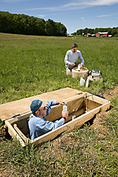
Bryant and colleague Arthur Allen from the University of Maryland-Eastern Shore (UMES) have developed a way to trap the “legacy phosphorus” from the region’s poultry farms that leaches from soils to drainage ditches. Working at an experimental farm owned by UMES—the site of a former chicken farm—they dug a trench alongside an existing drainage ditch. Then they filled the trench with synthetic gypsum, a product of scrubbing the smokestacks of coal-fired power plants to remove sulfur emissions.
When the groundwater passed out of the field and through the gypsum-filled trench on its way to the drainage ditch, the soluble calcium in the gypsum “captured” the soluble phosphorus in the water by combining with it and forming calcium phosphate. Calcium phosphate is similar to rock phosphate, which is the source of phosphates used to make fertilizer. Bryant found that the gypsum trench could treat all the water draining from a field and reduce soluble phosphorus in subsurface drainage by about 50 percent.
|
|
“These gypsum ‘curtains’ are good for 10 years,” Bryant says. “Then they can be dug up, and the trapped phosphorus can be used again for fertilizer. And the power plants don’t have to pay to haul the gypsum to a landfill.”
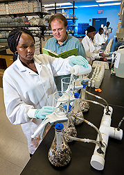
ARS chemist Clinton Church is also dealing with a legacy: arsenic.
“Although the practice is falling out of favor, historically arsenic was routinely added to poultry feed to control parasites and help the birds gain weight. But 90 percent of the arsenic is excreted, and when the litter is used to amend the soil, the arsenic ends up in the fields,” Church explains.
Church, Allen, and others conducted a comprehensive survey of soils around the UMES Research and Teaching Farm and in forested areas around the farm and found that virtually all of the samples contained some arsenic. Levels were low in the forested soils and notably higher in the soils that were closer to the source of the litter, such as the shed where the litter was stored.
“Arsenic can occur naturally in soils, so this study is a first step to find out where the arsenic is and how much is there,” Church says. “But since its chemical structure is very similar to the chemical structure of phosphorus, we know it has to be ending up in the region’s estuaries.” He is hopeful that some of the filtration methods Bryant is testing will also work to remove arsenic.
|
|
The Big Picture
Kleinman thinks the University Park research helps provide a broader perspective on the effort that will be needed to clean up a 65,000-square-mile watershed.
“There’s a real risk of focusing on local issues to derive conclusions about what is best for the Chesapeake Bay,” Kleinman says. “For instance, the Eastern Shore is only 6 percent of the Chesapeake Bay Watershed, but for many people, it’s the biggest part of the story. We need to look at agricultural practices throughout the watershed, because the entire watershed contributes to the health of the bay.”—By Ann Perry, Agricultural Research Service Information Staff.
This research is part of Water Availability and Watershed Management (#211), Global Change (#204), and Manure and Byproduct Utilization (#206), three ARS national programs described at www.nps.ars.usda.gov.
To reach scientists mentioned in this article, contact Ann Perry, USDA-ARS Information Staff, 5601 Sunnyside Ave., Beltsville, MD 20705-5129; (301) 504-1628.
"There’s More Than One Way To Save the Bay" was published in the August 2010 issue of Agricultural Research magazine.