| Geomorphic Analysis of the Yalobusha River Watershed, MS |

|
|
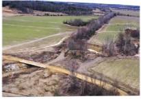
The potential for catastrophic flooding along downstream reaches of the Yalobusha River has dramatically increased since the early 1960's. As a consequence of channel adjustment processes related to channelization in the late 1950's and early 1960's, upstream migrating knickpoints have caused deepening of upstream reaches and tributary channels. Sufficient deepening occurred to cause significant channel widening by mass failure of channel banks. Woody vegetation growing on these channel banks was delivered to the flow and was transported downstream to form large debris jams. Sediment eroded from the boundary of the Yalobusha River, its tributaries, and from upland areas is deposited in downstream reaches, reducing flow capacity. The debris jams function as dams and cause higher water levels and slower flow velocities than previous. This is turn causes even greater rates of deposition, further reductions in channel capacity, and an increase in the magnitude and frequency of floods. The U.S. Army Corps of Engineers plans to mitigate problems on the Yalobusha River by adopting measures to reduce the potential for catastrophic flooding and to protect upstream reaches from further erosion. To assist the Corps of Engineers in developing a Technical Work Plan for mitigating drainage and erosion problems in the watershed, historical data and field work is used to develop an empirical model of channel change during the past 30 years. Relations developed from this analysis will then be used to extrapolate channel changes and conditions into the future. This will include changes in bed elevation as well as channel width. Knickpoints are identified, monitored, and evaluated within the main channel and tributaries. Stages of channel evolution, which are determined for 190 miles of channels by site evaluation and sampling, provide information on past, present, and future channel processes. A numerical model of channel evolution, developed by scientists at NSL will be used to evaluate and predict channel changes given the new boundary conditions and flow regime imposed by the mitigation measures. Data on entrainment and transport of cohesive (silt-clay) bed material will be obtained experimentally and used in the numerical model. Point of Contact:Dr. Andrew Simon, Retired |

