
This page has been archived and is being provided for reference purposes only. The page is no longer being updated, and therefore, links on the page may be invalid.
| Read the magazine story to find out more. |
|
|
|
|
ARS Scientists Verify Soil Moisture Data Collected by Satellites
By Ann PerryAugust 9, 2013
Researchers at the U.S. Department of Agriculture (USDA) may have their feet on the ground, but they're also the go-to experts when it comes to interpreting data from space.
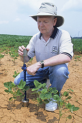
In 2002, Agricultural Research Service (ARS) scientists established soil moisture monitoring networks in four long-term experimental watersheds to verify the accuracy of soil moisture data collected by satellites orbiting Earth. Since then, the ARS researchers have been continuously monitoring soil moisture levels in these watersheds every hour. As a result, they had a vast amount of data they could use to validate soil moisture data collected by a new Earth-orbiting satellite launched by the European Space Agency as part of its Soil Moisture and Ocean Salinity (SMOS) mission.
ARS is USDA's chief intramural scientific research agency, and this work supports the USDA priority of responding to global climate change.
The new SMOS satellite used an innovative sensor technology to estimate soil moisture levels to within 4 percent, which is like measuring a teaspoon of water mixed into a handful of dry soil. But the accuracy of the data needed to be verified with actual soil moisture measurements.
An ARS research team led by hydrologist Tom Jackson compared a year's worth of soil moisture data collected by SMOS with data from the four ARS watersheds, and with data from another satellite system. Jackson works at the ARS Hydrology and Remote Sensing Laboratory in Beltsville, Md.
The scientists determined that the SMOS soil moisture estimates approached a 95 percent rate of accuracy. They also identified conditions that reduced the accuracy of their estimates, such as fluctuations in daily weather conditions, and devised a method for flagging and adjusting these data to improve the accuracy of the resulting soil moisture estimates.
Results from this project were published in 2012 in IEEE Transactions on Geoscience and Remote Sensing.
Read more about this research in the August 2013 issue of Agricultural Research magazine.