| res01 |

|
 |  | ||||
|
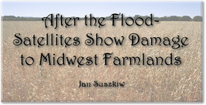
June 26-July 8, 1993. The predominant colors for the first set of satellite images are glaring red and yellow. Rashlike, they spread across southern Minnesota, most of Iowa, northern Illinois. By September, the red has subsided, giving way to shades of green fringed, here and there, by traces of yellow. The images and their colors may seem at first glance to be no more than eye-catching murals. But to ARS researchers they tell a story: where, and how seriously, unprecedented flooding in the Midwest last summer affected corn, soybeans, and other crops. ARS agricultural meteorologist Paul C. Doraiswamy produced the maps using data collected from a satellite that orbits about 537 miles above the Earth. Assigned to ARS' Remote Sensing Research Laboratory at the Beltsville (Maryland) Agricultural Research Center, he uses satellite imagery to monitor crop conditions and seasonal productivity-especially in times of natural events such as flooding, drought, or insect infestations. During the 1993 flood, Doraiswamy and assistants Richard Strub and Wei Xia developed satellite images of the Midwest and produced them as regional and country-scale maps. The research was part of ARS' cooperative research with the USDA's National Agricultural Statistics Service (NASS). "The images showed what the growth of the crops was and how long the crops were inundated with water left from the flooding," Doraiswamy says. "We were also able to figure out which counties in the states were flooded and how much of their crop acreage was damaged." The maps, in addition to field surveys and other means, helped NASS' monthly Agricultural Statistics Board to assess potential crop losses as a result of the flooding. These estimates, in turn, helped crop insurance agencies deliver assistance to farmers in Iowa, Illinois, Minnesota, Missouri, and other flood-affected states. Doraiswamy furnished NASS with six of the 30- by 40-inch maps-one every 2 weeks, from early June to late August. Each was color coded to display the relative abundance or scarcity of vegetation according to how the flooding affected crop growth. The colors, Doraiswamy says, corresponded to a normalizeddifference vegetation index based on the satellite's measurements of specific light wavelengths reflected by the vegetation. Colors for the maps ranged from green-showing regions with healthy, dense vegetation-to red, indicating sparse, slower growing vegetation. "The seasonal change in the index tells you how well the crops are doing at particular stages of their development," Doraiswamy says. He determined the extent to which flooding affected crop growth by comparing the vegetation difference for each bi-weekly period between the 1993 maps and those for 1992. Based on maps for July 1993, for example, he estimates that heavy rainfall and flooding affected-but did not destroy-about 20 million acres of corn and soybean crops in Iowa, Illinois, Minnesota, and Missouri. According to a NASS Crop Production report for August that was based on both direct and satellite observation, crops were actually destroyed on about 1,250,000 acres of corn and soybeans in Iowa; 600,000 in Illinois; 900,000 in Minnesota; and 850,000 in Missouri. Kansas, Nebraska, North Dakota, South Dakota, and Wisconsin also sustained crop losses from the flooding. As of March 3,1994, USDA emergency assistance to the nine affected states totaled about $2.3billion, says a report from the USDA Flood Information Center in Washington, D.C. Of funds for wastewater cleanup, livestock feed, soil conservation, and other flood-induced emergencies, about $1.2 billion went toward disaster programs for lowyield crops. Payment for crop insurance for farmers was $1 billion. Other than destroying crops altogether, flooding typically reduced yields by delaying the crop's development and by carrying away nitrogen fertilizer and other nutrients from the fields through runoff. On the mapsespecially those for early June and July-such areas appear as yellow and, in more severe cases, as red because of delayed crop development. Some of the worst-hit crops were grown in the upper Mississippi Valley or near the lower Missouri River-regions where excessive rainfall early last June prompted the heaviest flooding. NOAA and the Flood NOAA-AVHRR-a satellite equipped with an "Advanced Very High Resolution Radiometer" sensor-generated data for the maps' color indices. ARS uses several such satellites, thanks to cooperative research agreements with the National Oceanic and Atmospheric Administration. "NOAA-AVHRR is one of three major satellites most commonly used by researchers for assessing natural resources," Doraiswamy says. [SPOT and LANDSAT are the other two.] "I used data from the NOAA-AVHRR satellites so I could look at large areas on a daily basis." The satellite, he notes, also afforded the opportunity to observe the flood's cumulative effect on development of crops throughout the 1993 growing season-a feat virtually impossible with field-by-field surveys As it passed over the Midwest each day, the satellite measured the spectral reflectance of radiation in visible and near infrared wave bands reflected off water, soil, and any vegetation within each 105-acre square. Once collected, the measurements were periodically beamed by satellite to computers operated by the U.S. Geological Survey's EROS (Earth Resources Observation Service) Center at Sioux Falls, South Dakota. The ARS lab obtained these measurements as both raw and processed data every 2 weeks Special computer software at the ARS lab later categorized the radiation measurements for computing the biweekly changes in the amount of green vegetation reported on the maps. Doraiswamy says they then took that digital information, calibrated it, and converted it into images using the Land Analysis System software developed by National Aeronautics and Space Administration researchers at the Goddard Space Flight Center in Greenbelt, Maryland. The software also projected the images onto the maps and shaded them according to the relative vigor and density of vegetation on the ground. Doraiswamy plans to combine the software with agro-climatic models that use weather data to rapidly assess crop conditions and forecast yield estimates. That could help statistics-gathering agencies like NASS or USDA's Foreign Agricultural Service to keep a closer watch on U.S. and foreign crop production throughout the growing season.-By Jan Suszkiw, ARS. Paul C. Doraiswamy is with the USDA-ARS Remote Sensing Research Laboratory, Bldg. 001, Beltsville Agricultural Research Center, 10300 Baltimore Ave., MD 20705-2350; phone (301) 504-6576, fax (301) 504-5031. -4 | |||||