 Image Number K4911-6 |
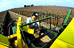
In Missouri, agricultural engineer Kenneth Sudduth examines corn from this combine's grain flow sensor. The combine is linked to the satellite-based GPS, allowing precise yield and location data to be correlated with soil samples taken earlier throughout the field. This information will help growers plan best fertilizer rates for the next crop.
Photo by Bruce Fritz

