 Image Number D423-1 |
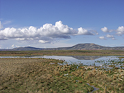
This stretch of rangeland in the Muddy Creek Watershed in Wyoming’s Red Desert is typical of the vast expanses of publicly owned rangeland that aerial remote sensing is particularly well-adapted to.
Photo by Sam Cox.
 Image Number D423-1 |
This stretch of rangeland in the Muddy Creek Watershed in Wyoming’s Red Desert is typical of the vast expanses of publicly owned rangeland that aerial remote sensing is particularly well-adapted to.
Photo by Sam Cox.