
 Image Number K10384-1 |
Aerial image of the Paul Good Farm in Mississippi's Noxubee County showing the type of crop or vegetation in the area.
Photo supplied by Geovantage, Inc.

An official website of the United States government
Official websites use .gov
A .gov website belongs to an official government organization in the United States.
Secure .gov websites use HTTPS
A lock (
) or https:// means you’ve safely connected to the .gov website. Share sensitive information only on official, secure websites.
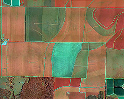
Image Number K10384-1 |
Aerial image of the Paul Good Farm in Mississippi's Noxubee County showing the type of crop or vegetation in the area.
Photo supplied by Geovantage, Inc.