
300 dpi: (k8466-1.jpg)
640 pixels wide: (k8466-1.jpg)
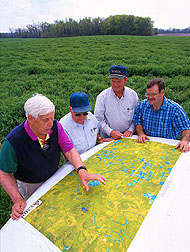 Image Number K8466-1 |
Left to right: Project coordinator Frank Gwin, farmers T.A. Murtagh and David Walker, and soil scientist Martin Locke review an aerial map of Mississippi Delta counties involved in the Management Systems Evaluations Area project.
Photo by Scott Bauer.
