 Image Number K8376-2 |
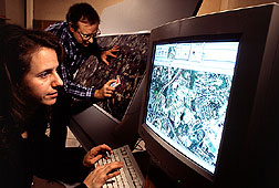
Sara Loechel, a remote sensing researcher at the University of Maryland, labels fields, woodlands, and streams on a computer, while ARS agronomist Craig Daughtry locates the same features on an aerial photograph of the Beltsville [Maryland] Agricultural Research Center. The computer image will form the base layer of a geographic information system map. Other data about soils, crops, and management practices will be added, along with remotely sensed images of crops to update their growth and development.
Photo by Keith Weller.

