
| D4216-1 |

|

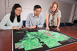
Image Number D4216-1 |
HRSL scientists (left to right) Yun Yang, Feng Gao, and Martha Anderson view high-resolution maps of evapotranspiration (ET), or crop water use, over various agricultural landscapes in the United States. These maps were generated with a multi-sensor data fusion approach, leveraging information about land-surface temperature and evaporative cooling that can be obtained with spaceborne thermal infrared imaging. These ET datasets can be used to manage irrigation, estimate drought impacts on yield, and map crop water productivity.
Photo by Peggy Greb.
Please visit our Image Gallery.