
| Wind Erosion |

|
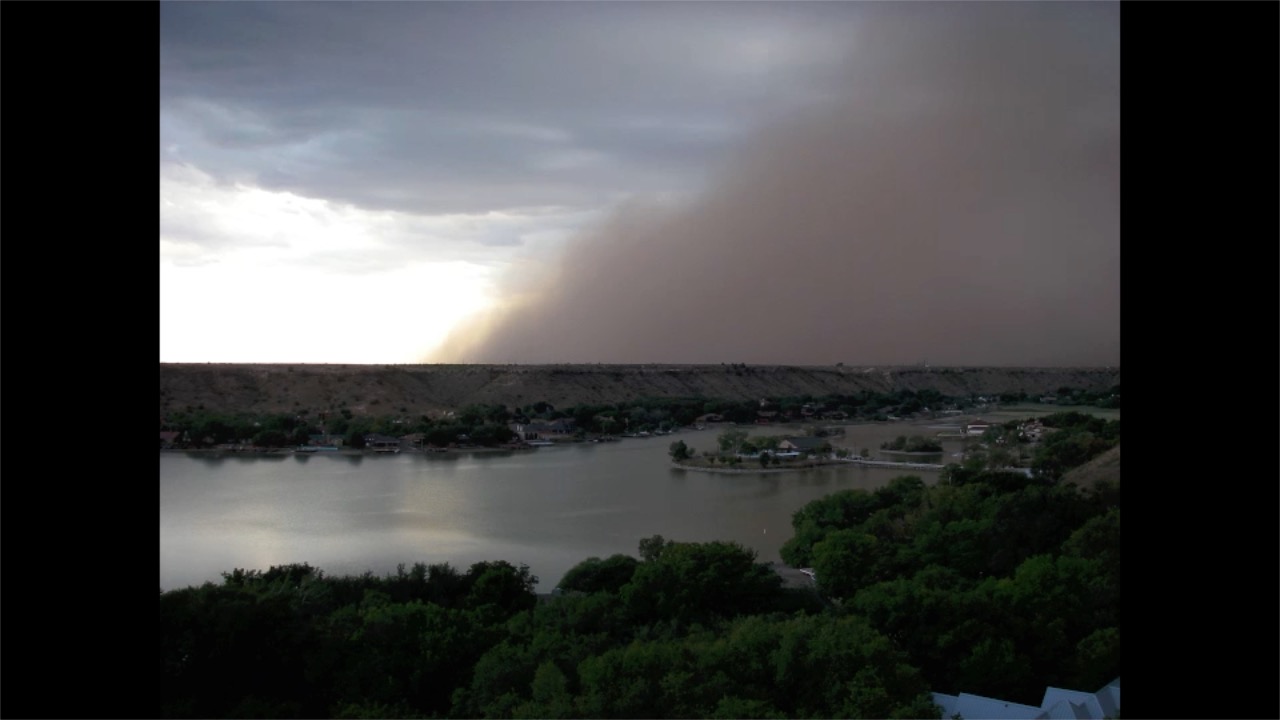 Video of a Haboob in Lubbock Texas 2011.
Wind Erosion and Dust Storms in the US
The Southern Great Plains is a vast area of multiple uses by agricultural producers including irrigated cropland, dryland (rainfed) cropland, and grazing of pastures and native grasslands. For the purposes of this proposal, we shall consider the area to range from 32o N (Big Spring, TX) to 41o N (Cheyenne, WY) latitude and 98o W (El Reno, OK) to nearly 105o W (Cheyenne, WY) longitude (Fig. 1). This area encompasses an area of the North American breadbasket that has rainfall amounts from 430 mm to 890 mm, altitudes from 1850 to 410 m MSL, and mean frost-free growing periods from 137 to 207 days from the northwest to the southeast, respectively. Although most of this area is used for grazing, an area this diverse has crops that reflect the climatic ranges; cotton (Gossypium hirsutum L.), irrigated and dryland, is generally grown in the southern portion of this area due to heat unit requirements and length of growing season, while corn (Zea mays L.), dryland, due to its high water use is grown in the eastern portion of this area and under irrigation in the southern portions of the area. Wheat (Triticum aestivum L.), dryland and irrigated, is grown throughout the area for winter grazing and grain.
The United States Department of Agriculture (USDA) has had a research presence in this region for more than a century. Since the 1950s, the Agricultural Research Service has administered and expanded this network. Currently, there are research stations at Big Spring, Texas, El Reno, Oklahoma, Lubbock, Texas, Woodward, Oklahoma, Bushland, Texas, Akron, Colorado, Cheyenne, Wyoming, and Ft. Collins, CO. In this group of research stations, there are currently four installations supporting the National Wind Erosion Research Network (NWERN) at Big Spring, El Reno, Akron, and Cheyenne and two Experimental ranges, the Southern Plains Experimental Range (SPER) and the Central Plains Experimental Range (CPER). The Grazing Lands Research Laboratory in El Reno, Oklahoma and the CPER are currently Long-Term Agroecosystem Research (LTAR) sites.
In the last decade, the Texas Panhandle, Northwest Oklahoma, and Southwest Kansas have witnessed several years when wildfires have burned in excess of 300,000 acres. While the science is clear that fire was an important ecological process in the region prior to settlement and continues to benefit ecosystems today; prescribed fire is what is needed and these wildfires, especially at the scale and intensity seen in the last decade are an unwelcome development. On rangelands, fire is perhaps the greatest disturbance that will occur in terms of opening a window of increased soil erodibility. Intense fires can remove nearly all the protective vegetation and in most cases the large wildfires of late are associated with very dry and windy conditions and sandy sites may begin eroding before the fires are extinguished. Depending on the conditions following the fire, fire tolerant vegetation will eventually sprout and the window of increased soil erodibility begins to close. With the increasing risk of large intense fires in the region, encroachment of woody vegetation that has weakened the ability of herbaceous plants to quickly provide cover, and the large expanses of sandy rangelands in the region it is important that we address the issue by better quantifying the risks and determine ways of mitigating the risk of wind erosion after fire.
ARS Wind Erosion Research
The USDA-ARS has been a global leader in the study of soil erosion processes and the development of predictive equations for estimating wind and water erosion. Although great improvements to cropping systems have resulted in reduced rates of soil erosion in croplands, the ambient dust levels in March have increased by 4% to 5% per year for the last two decades (Hand et al., 2017) in this region. Indeed, wind-induced erosion of soil has increased on rangelands in 8 states of the western U.S., including this region and in 6 western states on Conservation Reserve Program (CRP) land, including all states in our region of interest (USDA-NRCS, 2015). In much of this area, extended droughts have contributed to the invasion of shrubs and depletion of native grasses, resulting in decreased soil surface cover and increased susceptibility of the soil surface to the erosive forces of wind (Li et al., 2007: Okin, 2008; Bestlemeyer et al., 2018). The NWERN was initiated at the Jornada Experimental Range (JER), also an LTAR site, in the Chihuahuan Desert ecoregion. Recently, analysis of satellite imagery has identified soil dust emissions at over 1000 points in the Southern Great Plains, mostly in the areas immediately southwest of Lubbock and at 249 points in the Chihuahuan Desert surrounding the JER (Kandakji et al., 2020). In addition, modelling by Chappell and Webb (2016) indicates that these regions are among the most wind erosion prone in the United States. In order to build bridges of wind erosion research both in terms of geographical and collaborative perspectives, we propose that the Wind Erosion and Water Conservation Research Unit in Lubbock and Big Spring, Texas and the Rangeland and Pasture Research Laboratory of Woodward, Oklahoma be designated satellite sites of the existing LTAR at the Grazing Lands Research Laboratory of El Reno, Oklahoma.
Labs & People
Las Cruces
Lubbock/Big Spring
Fort Collins
Reno